
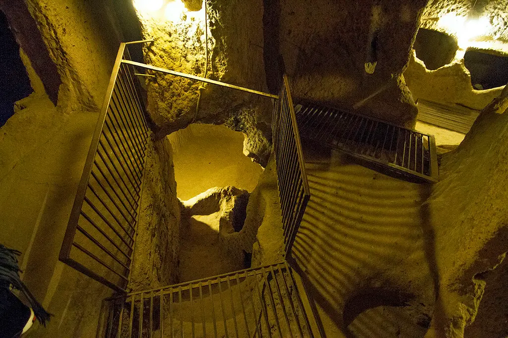
Derinkuyu Underground City is the deepest excavated underground city in Cappadocia, Turkey — it descends roughly 85 meters through at least 18 carved levels, of which 8 are open to visitors. It lies beneath the town of Derinkuyu in Nevşehir province, about 40 minutes south of Göreme, and it held not just people but their livestock, food stores, wine presses, a school and a church. It was not a home. It was a hiding place, built by people who expected to need one.
In 1963 a Derinkuyu householder knocked through a wall during renovations and found a room that was not on his plan. Behind it, another. Behind that, stairs going down. The town, it turned out, was sitting on a second town — one dug straight down through the tuff, level under level, to a depth of roughly eighty-five meters.
Nobody dug that much rock for fun. Cappadocia’s plateau lies on the road every army in Anatolian history wanted to use, and its soft stone offered the locals a persistent answer: disappear. The earliest chambers may be Phrygian, from the eighth century BC; the city reached its astonishing final depth under the Byzantines, when Arab raiding seasons made vanishing a regular civic exercise, practiced like a fire drill.
How a buried city works
The layout reads like a manual of siege logic. Stables sit near the surface — animals need the least climbing and the most mucking-out. Below them, living rooms, kitchens whose soot still blacks the ceilings, storage for oil and grain, wine presses (morale is logistics), a school with a barrel-vaulted study room, and on the deep levels a cruciform church and a missionary school. Wells reached below the water table, and — the masterstroke — dozens of ventilation shafts ran the full depth, moving air well enough that a fire on level two did not smother level seven.
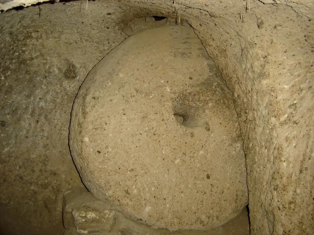
Security was architectural. The famous millstone doors — stone wheels up to half a meter thick — rolled across key passages from carved slots and could only be worked from inside. Corridors force single-file stooping precisely where a defender would want an attacker bent over and blind. Even the wells avoided the surface, so no besieger could poison them. It is quietly relentless design, made by people who expected to need it.

A map of Derinkuyu, level by level
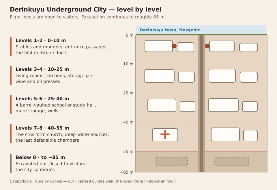
No single published plan of Derinkuyu is complete — surveying a warren carved by hand over centuries is genuinely difficult, and new passages still turn up. What is agreed is the vertical logic, and knowing it before you go is the difference between a dim corridor and a legible city:
| Level | Depth | What is down there |
|---|---|---|
| 1–2 | 0–10 m | Stables and mangers, entrance passages, the first millstone doors |
| 3–4 | 10–25 m | Living rooms, kitchens with soot-blackened ceilings, storage jars, wine and oil presses |
| 5–6 | 25–40 m | A barrel-vaulted room usually read as a school or study hall, more storage, wells |
| 7–8 | 40–55 m | The cruciform church, deep water sources, the last defensible chambers |
| Below 8 | to ~85 m | Excavated but closed to visitors — the city continues |
A printed map is sold at the entrance and the route itself is arrowed and one-way, so nobody gets lost. What you will lose is your sense of depth — almost everyone surfaces convinced they went down two levels fewer than they did.
Tickets, hours and how long it takes
Derinkuyu is a state site, ticketed by the Turkish Ministry of Culture and Tourism, and the price is set annually — which is why we quote it fresh rather than printing a number that rots. It is included in the regional Museum Pass Cappadocia, which starts paying for itself around the third ticketed site. Allow about an hour underground; the site opens daily with shorter winter hours. Current prices and the pass arithmetic are on our entrance fees page.
Visiting: what it is actually like down there
The open route covers eight levels with one-way circulation, lighting throughout and arrows for the honest reason that without them nobody would come back out. It is cool (bring a layer — it holds 13–15°C in every season), low in stretches (expect to stoop through connecting passages roughly 1.5 m high), and absolutely transformed by a guide — the rooms do not label themselves, and the difference between “a hole” and “the ventilation shaft that kept a civilization alive” is somebody telling you which is which.
It anchors our Cappadocia Green Tour and the dedicated Derinkuyu underground city tour; the gentler alternative, with wider corridors and fewer levels, is Kaymaklı.
Sources & further reading
- UNESCO: Rock Sites of Cappadocia — includes the underground settlements
- Britannica: Cappadocia — historical background